
Leinster Orienteering Championships 2018
Ajax are proud organisers of the 2018 Leinster Orienteering Championships in the Vale of Clara & Ballinastraw, Rathdrum, County Wicklow on Sunday February 25th 2018.
About us
AJAX is an orienteering club based in Dublin, Ireland... More
IOA Policy
Ajax Orienteering Club implements the Irish Orienteering Association's anti-doping, anti-discrimination, child-protection and land-access policies, details of which are available on www.orienteering.ie
AJAX Child Safeguarding Statement (CSS)
AJAX Child Safeguarding Statement (CSS)
News
Ajax Committee 2023
Chairman:
John O'Donovan
Secretary:
Oisin Wall
Treasurer:
Mike Long
Mapping:
Paul
Children and Liaison:
Donal Wickham
Equipment:
John DeLacy
Webmaster:
Marcus Geoghegan
Did you know?
You can use RSS to keep up to date with changes to the website. Use the RSS link at the bottom of this column with your favourite RSS reader.
Contact Ajax
Our Photostream
We have set up a Flickr account so that club members can share their photos on line. It also allows photos to be displayed on this website.
Useful Links


Copyright on all material lies with Ajax Orienteering Club or the original copyright holders. Permission should be sought before use.
Mar 09, 2009
Bull Island Leinster Spring Cup
Sunday March 15th, 2009
Start times from 11AM until 1PM
The competition area is an intricate sand dune system surveyed and mapped by Aonghus O'Cleirigh. Aonghus has recently extended the map northwards and so this year's event includes some areas that are new to orienteering. Aonghus is also planning the courses.
This event promises to be exciting, fast, complex and spectator friendly - don't miss it. Longer courses will have a map exchange. 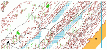
Directions: Turn off the Clontarf road onto the causeway road -the assembly area is near the roundabout at O233370. There will be a signpost at the causeway road/clontarf road junction. Note: there is no access to the event via the wooden bridge at the south end of the island.
Dart, Cycle & Dublin Bus: The nearest Dart station is Raheny (2.75km). There is a cycle track along the Coast Road which is an ideal way to reach the event. Dublin Bus 130 runs every 15 minutes (Sunday Schedule) from Lower Abbey Street to the wooden bridge to the Island.
Here is an aerial view of the island and the surrounding area.
Parking: please do not park on the access road to the beach – use the tarmac road before the roundabout or the parking area on the beach itself.
SportIdent: All courses use SportIdent. There are no pin-punches on the controls. Rental SportIdent cards can be hired from registration and these must be handed back at the download station. You must download after finishing.
Course Planner’s Notes: The competition area consists of coastal sand-dune terrain without tree cover, mapped at a scale of 1:5,000 with a 2.5m contour interval. The north lines on the map are aligned at 45° to the edge of the paper. The dune features are relatively small with the highest point on the map being about eight meters above sea-level. Navigation is aided by man-made features – paths, buildings and other constructed objects. The area is used extensively by the public for recreational purposes. Only relatively distinct paths are mapped. The terrain is very runnable with a covering of various types of grasses. All courses cross freshwater marshes which are firm underfoot and easily passable. The map deviates from IOF mapping specification in that open sand is represented by 100% yellow. A line of telegraph poles running the length of the competition area has been omitted from the map in order not to over-simplify navigation.
Planner: Aonghus O'Cleirigh, Ajax
Mapper: Aonghus O'Cleirigh, Ajax
Controller: Mike Long, Ajax
Organiser: Denis Reidy, Ajax
Map:
Maps are pre-marked and printed at a scale of 1:5,000 on water resistant material. Contour interval is 2.5 meters.
Course Lengths:
Brown 9.6k, 50m climb, 28 controls, Map Exchange
Blue 7.2k, 35m climb, 27 controls, Map Exchange
Green 4.6k, 25m climb, 23 controls
Light Green 2.9k, 15m climb, 17 controls
Orange 2.0k, 15m climb, 5 controls
Yellow 1.5k, 10m climb, 12 controls
Condition of entry:
· Please use crossing points marked on map.
· For safety reasons do not cross public roads or race on them.
· Down load your SI card, whether you complete the course or not.
· Bull Island is a EU designated Special Area of Conservation. Do not cause damage or litter.
· Orienteering is an adventure sport. You compete at your own risk.
Entry Fees:
For members of an orienteering club:
Adult: 8 Euro.
Junior/Full time student 5 Euro
Family 20 Euro
For non-members of an orienteering club
Adult: 10 Euro.
Junior/Full time student 6 Euro
Family 25 Euro
Ajax Orienteering and Hill Running Club wishes you a great run and an enjoyable day!
A History of Bull Island
Bull Island, which was first mapped for orienteering for the 2006 Leinster Championships, came into existence quite by accident less than 200 years ago. Here is how it all happened. By late 18th century Dublin was a thriving port, but a sandbar at the mouth of the River Liffey constituted a major hazard. Only 6 feet of water cleared the obstacle at low tide and many lives, ships and cargoes were lost. To improve access to the Port a 3.5-mile stone breakwater (the Great South Wall) extending to a point now marked by the Poolbeg Lighthouse was built in 1795 to prevent silting of the shipping lane. Unfortunately the structure did not achieve its intended purpose.
In 1801 Captain William Bligh (of Mutiny on the Bounty fame/notoriety) suggested that a wall be built on the Northern Bank of the Liffey parallel to the Great South Wall. The proposal was seriously considered by the Port of Dublin, but was superseded by a broader plan, which led to the construction of the existing North Bull Wall. The breakwater, designed by Francis Giles and George Halpin, was completed in 1824 and stretches for 1.7 miles from the shore of Dollymount to the North Bull Lighthouse at the entrance to the Port. Its purpose was to deepen the Liffey Channel using the natural scouring action of the river, and also to prevent the movement of a sandbar on to the Clontarf shore. The Wall did succeed in deepening the channel to a depth of 16 feet at low water. But the sand dislodged was carried by currents and deposited on the North Bull Bank. Bull Island came into existence and has been growing steadily since.
Today the island is 5.6 km in length and 1 km in width, and is home to two golf courses, and a wide range of natural habitats including sand dunes, salt march, freshwater marsh, and beach area. The EU has designated Bull Island a Special Protection Area and a Special Area for Conservation.
William Bligh was born at Plymouth, England on 4 Oct 1754. After entering the Navy he sailed with James Cook on his second voyage around the world (1772-74). He saw service in Naval battles in 1781 and 1782, and in 1786 when the Commission for the Port of Dublin was established, he was taking part in the naval blockade of French ports.
In late 1787 he was assigned to HMS Bounty. While sailing from Tahiti to the West Indies he and 18 of his crew were overpowered and set adrift in a small boat in the Pacific (April 1789). Bligh's skill as a navigator of the highest quality was demonstrated by his ability to sail the Bounty's lifeboat to Timor, a distance of 3618 miles with only a sextant as a navigational aid. He returned to England in 1790 and continued his career in the Navy.
Captain William Bligh was invited to survey Dublin Bay by the Directors General of Inland Navigation in Ireland. He had a terrific reputation, earned in the South Seas, as a skilled navigator and marine surveyor. Bligh arrived in Dublin in Sept 1800 and completed his survey and report in three months. The chart based on his survey was extraordinarily accurate and detailed, and was greatly superior to all previous charts. He proposed the construction of a wall on the north side of the channel parallel with the South Wall to speed the flow of water and to combat silting. This proposal was accepted in principle.
He returned to his naval duties in early 1801 and fought under Nelson in the Battle of Copenhagen in that year. He was appointed Governor of New South Wales, Australia, in 1805. An army mutiny took place in the colony during which Bligh was deposed and held in custody until Feb 1808. He returned to England in 1810 and in 1811 was promoted Rear Admiral. In 1814 he was elevated to Vice Admiral. Bligh died in London in 1817.
AO’C (Material sourced from Dublin Port Authority and from Dublin City Council.)
see also Bull Island on wikipedia
17:03 | Permalink | Comments (0)
Mar 05, 2009
Photo of the Photographer Djouce Mar 2008
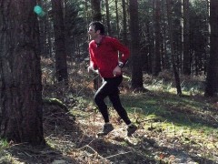 Hard to get photos of these photographer guys, but Farina Freigang caught this fellow, Martin Flynn (AJAX) cutting up through the forest without his camera.
Peter Kernan
14:10 | Permalink | Comments (0)