
Leinster Orienteering Championships 2018
Ajax are proud organisers of the 2018 Leinster Orienteering Championships in the Vale of Clara & Ballinastraw, Rathdrum, County Wicklow on Sunday February 25th 2018.
About us
AJAX is an orienteering club based in Dublin, Ireland... More
IOA Policy
Ajax Orienteering Club implements the Irish Orienteering Association's anti-doping, anti-discrimination, child-protection and land-access policies, details of which are available on www.orienteering.ie
AJAX Child Safeguarding Statement (CSS)
AJAX Child Safeguarding Statement (CSS)
News
Ajax Committee 2023
Chairman:
John O'Donovan
Secretary:
Oisin Wall
Treasurer:
Mike Long
Mapping:
Paul
Children and Liaison:
Donal Wickham
Equipment:
John DeLacy
Webmaster:
Marcus Geoghegan
Did you know?
You can use RSS to keep up to date with changes to the website. Use the RSS link at the bottom of this column with your favourite RSS reader.
Contact Ajax
Our Photostream
We have set up a Flickr account so that club members can share their photos on line. It also allows photos to be displayed on this website.
Useful Links


Copyright on all material lies with Ajax Orienteering Club or the original copyright holders. Permission should be sought before use.
Aug 25, 2009
Vale of Clara Nature Reserve
Here is status of the Cronybyrne map update. In an email to the Ajax eGroup I have asked the club's opinion on changing the name from “Cronybyrne” to “Vale of Clara Nature Reserve” and I would appreciate your comments on this (via the Ajax egroup).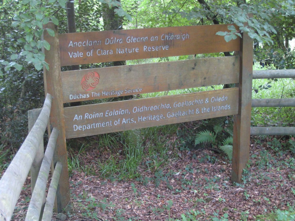
The Brown, Blue and Black features from the 1993 map have been vectorised in OCAD (contours, water, paths, crags, boulders, marshes etc). The final product will be a 1:10,000 map in portrait orientation.
I have re-surveyed about 25% of the area, mostly in the North-West corner; after a very slow start the re-survey is now going well and I expect to be finished before the end of September. I am only surveying areas to the east of the Avonmore river – there is a narrow strip of forestry on the west side that was on the old map, but the river is not crossable and there are no bridges. Ballinastraw is not included in this project.
Here is a pdf of the map so far; do not be deceived by the whiteness of it – many areas of yellow, green and green hatching have yet to be added.
My main findings so far are:
- The map is now nearly all broadleaf, but some small self-seeded coniferous areas remain.
- Some bramble has died - I think the high oak canopy has deprived it of enough light. However some areas of bramble remain and I am mapping these with symbol 409.0 "Undergrowth - Difficult to run" (closely spaced green lines). I haven't yet found any totally new area of bramble.
- The pre-dominant features on the forest floor are Fraochán bushes (aka Bilberry) and bracken ferns. In some areas the bracken is very high and difficult to traverse so I am mapping these areas with symbol 407.0 "Undergrowth - Slow Running" (widely spaced green lines), although the boundaries of these areas are vague.
- Many areas have high bracken at the edges, but a few metres in from the forest road, away from the light, this dies back to a more runnable forest floor. So a casual walk around the forest roads make the map seem more bracken-infested than it actually is.
- Most forest rides have disappeared. Some of the paths, and even roads, are becoming less distinct as the area reverts back to nature from it's previous commercial-forestry state.
- Most white-to-white vegetation changes have disappeared (i.e. thin dotted lines in areas of white indicating a vegetation change but not a change in runnability).
- The 1993 map had a lot of platform symbols on it (small brown triangles). This is no longer an ISOM standard and on Pat Healy's advice I am replacing these with small kinks in the contour lines to indicate spurs.
- The 1993 map had a lot of small “brown dot” knolls on it. Many of these were very small features to start with and now the change in the vegetation on the forest floor has made a lot of them effectively disappear. With great reluctance I am deleting some of them.
- Re-surveying some areas is really quick as these areas are essentially unchanged from the old map – it's just a matter of verifying that everything is the same.
- Re-surveying some areas is really slow as the vegetation has changed substantially. This is compounded by the disappearance of rides and vegetation changes and sometimes by high bracken.
- There are certainly enough areas of nice forest to stage very good Leinster League events, but course planners will need to be conscious of the undergrowth.
- There are some areas very suitable for junior and short courses, so both Brown/Blue and Orange/Yellow planning is equally feasible.
- There is good mobile phone coverage in most parts of the map.
- GPS coverage is surprisingly good – I have heard before that pine needles impede GPS reception while broadleaf coverage is not too disruptive and this theory seems to be holding true here.
- There is a new 110Kv power line across the bottom half of the map (not mapped yet), possibly serving the nearby Shering Plough chemical plant.
- As bracken is a significant feature of the area, it would probably be more suitable for Spring rather than Autumn events. However it is also a nature reserve and in order to build a good working relationship with the National Parks and Wildlife Service I think we should only look for permission for Autumn events to avoid bird nesting issues.
- There are no areas on the map that are suitable for parking cars; we will have to use the Coillte forestry above the road that bounds the map to the north. Regardless, I don't think the NPWS would give us permission to bring cars into the reserve and I don't think we should ask for it.
That's where it stands now and, all going well, in a couple of weeks I will be looking for people to check specific areas for me. This will involve visiting a defined small section and making sure that the map corresponds to what is on the ground. My rough estimate is that there will be 15 areas to be checked, each taking about 60 minutes. The area is north of Rathdrum, 50 minutes drive from Blackrock in Dublin. If you are available to help please email me at marcus dot geoghegan at gmail dot com.
The Vale of Clara Nature Reserve is a very special place, I think it is now a little-known wonder in south Wicklow. It is a pleasure to walk around it, especially early in the morning as it is teeming with wildlife. It is an integral part of the Dublin/Wicklow National Park.
The next time I visit the forest I will take some photos for this website
Marcus Geoghegan
10:44 | Permalink | Comments (0)
The comments are closed.