
Leinster Orienteering Championships 2018
Ajax are proud organisers of the 2018 Leinster Orienteering Championships in the Vale of Clara & Ballinastraw, Rathdrum, County Wicklow on Sunday February 25th 2018.
About us
AJAX is an orienteering club based in Dublin, Ireland... More
IOA Policy
Ajax Orienteering Club implements the Irish Orienteering Association's anti-doping, anti-discrimination, child-protection and land-access policies, details of which are available on www.orienteering.ie
AJAX Child Safeguarding Statement (CSS)
AJAX Child Safeguarding Statement (CSS)
News
Ajax Committee 2023
Chairman:
John O'Donovan
Secretary:
Oisin Wall
Treasurer:
Mike Long
Mapping:
Paul
Children and Liaison:
Donal Wickham
Equipment:
John DeLacy
Webmaster:
Marcus Geoghegan
Did you know?
You can use RSS to keep up to date with changes to the website. Use the RSS link at the bottom of this column with your favourite RSS reader.
Contact Ajax
Our Photostream
We have set up a Flickr account so that club members can share their photos on line. It also allows photos to be displayed on this website.
Useful Links


Copyright on all material lies with Ajax Orienteering Club or the original copyright holders. Permission should be sought before use.
Nov 17, 2010
Vale of Clara Nature Reserve
Leinster Autumn Series 2010 #4
Sunday November 21st 2010
Vale of Clara Nature Reserve, County Wicklow
Grid Reference T 185 923
Loc8 Code: SNQ-79-CX9
 The Vale of Clara Nature Reserve is the area formerly known to orienteers as Cronybyrne. The new 2009 map is a part of the larger Cronybyrne/Ballinastraw area initially surveyed in the early 1980s, incorporated into the Claravale map for the 1987 World Military Championships (CISM) and used for the 1993 Leinster championships as well as numerous Leinster League events.
Organised by: Ajax Orienteering Club, ajax.orienteering.ie
Online Check-In: This orienteering event is using an online check-in system - please use it as it will make things much easier for the hard-pressed organisers if they know in advance that you are coming to the event. However you will also be welcome even if you just turn up and enter on the day. The online check-in system will close at 10PM on Saturday November 20th. You can see who has already checked-in here.
Newcomers: This orienteering event is suitable for beginners and experienced orienteers alike. Bring clothing that is suitable for a day out in the woods, e.g. raincoat, boots/old runners and clothes that you don't mind getting dirty. It is best to arrive by about 11AM.
Groups: if you plan to bring a group to the event please email ajax@orienteering.ie as soon as possible so that we will have enough pre-printed maps.
Directions: There will be signposts from Laragh, County Wicklow. In Laragh turn south at Lynham's pub onto the Rathdrum road; after about 400m you will reach a junction where a small road goes straight ahead and the main road veers right across a narrow stone bridge. Take the small road straight ahead and drive for about 6.5km to the event. Parking will be in a Coillte forest north of the nature reserve - please follow the marshals' parking directions. For orienteers living near the N11/M11 there is a viable route via exit 15 for Ashford and onwards to Garryduff crossroads. This route will not be signposted.
Map: 1:10,000 with 5m contours, printed on waterproof paper, A4 landscape, updated Summer 2009 by Marcus Geoghegan, minor revisions Autumn 2010.
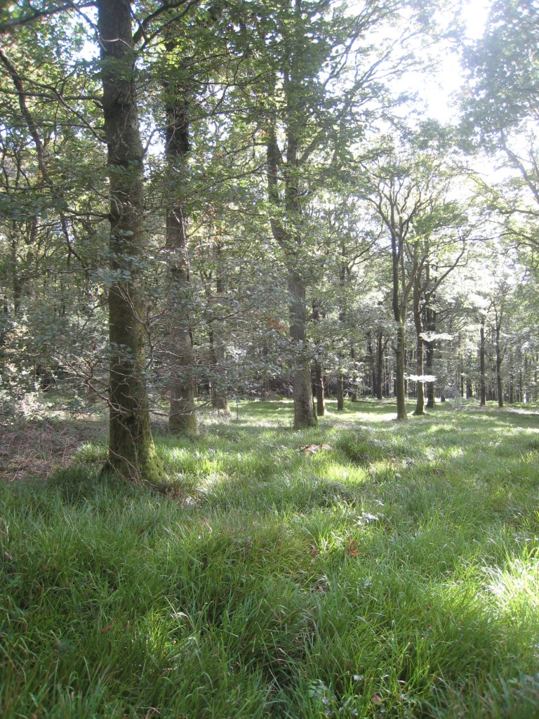
Terrain: Mature Oak woodland with occasional Scots Pine and Birch. Visibility is nearly always good but runnability varies - underfoot you will find sedge grass, Fraochán bushes (bilberry) and bracken fern. In some areas runnability is impeded by high bracken - these areas have been mapped with widely spaced green hatching. There are a few small areas of bramble which have been mapped with closely spaced hatching. During the 1990s a long-term project was started to return the Reserve to native woodland so most non-native trees (plantation conifer & hemlock) have been removed. Here are some photos of the terrain. The Irish Farmer's Journal has written a good article about the area's wonderful flora and fauna.
Sportident electronic timing will be used. Please make sure your sportident card is properly registered - it makes things a lot easier for the organisers. If you do not have a Sportident card, they will be available for hire for €2 each and you will be required to leave a deposit.
Registration will be at the car park entrance.
Start Times & Course Closure: starts are between 11AM and 1PM. Courses close at 3PM promptly and the controls will be collected at this time, so please make sure that you have reported to the download tent before 3PM.
Start: Approx 15 minutes walk from the parking/registration. The first 250m of this walk is along the road you travel to the event on. The remainder of the walk is along a quieter road that leads down to Clara bridge. Please accompany juniors.
Finish: Adjacent to the parking and registration area.
Download: when you return to the car park you MUST download your sportident card - the place to do this will be clearly signposted. You must download even if you retire and do not finish the course. Failure to download might lead to an unnecessary search and you will be unwelcome at future Ajax Orienteering events.
Clothing transfer: There will be no clothing transfer system in operation.
Safety & Cancellation: This orienteering event does not visit open mountainside. However it is November and inclement weather should be expected - a rain jacket/cagoule might be mandatory. All competitors must carry a whistle. If you get hopelessly lost walk north (usually uphill) along the forest roads until you reach the tarmac road where the car parking is located. The brown course crosses Cronybyrne Brook - please use the bridges and do not attempt to wade across. If the weather on the day is severe there is always the possibility of the event being cancelled - if you are in doubt please check the Ajax website (ajax.orienteering.ie) before travelling. The quarry in the centre of the map is dangerous and should not be approached from above; however no course is planned in the vicinity of the quarry. Horses occasionally use the Reserve - please watch out for them as a startled horse can be dangerous.
Control Descriptions will be printed on the front of the maps in IOF pictorial format, except for the yellow course which will have text descriptions. CONTROL DESCRIPTIONS WILL NOT BE AVAILABLE AT THE EVENT. You can download the control descriptions and print them yourself, or you can use the descriptions on the map. There will be no little bits of paper at the event!
Results:  weather permitting, live results will be displayed on a computer screen beside registration. Live results will also be available online - bookmark this page on your mobile phone so that you can see the results as they come in. Full results, including splitsbrowser, routegadget and winsplits will be available on www.orienteering.ie on the evening of the event.
Leinster Autumn Series: this event is the fourth of five in the 2010 Leinster Autumn Series - you can see the automatically updated current league standings in the results section of www.orienteering.ie. Best 3 of 5 to count.
Refreshments: tea/coffee/biscuits will be available near the registration.
Course: Length, Climb, #Controls : Suitability
Brown: 7.5km, 325m, 26 : very experienced orienteers only
Blue: 5.8km, 245m, 19 : experienced orienteers only
Green: 4.7km, 170m, 16 : experienced orienteers only
Light Green: 3.6km, 120m, 13 : improvers
Orange: 2.3km, 100m, 12 : "off the paths"
Yellow: 2.2km, 90m, 12 : novices/young juniors/families
Buggies: the yellow course is not suitable for buggies, however there are nice buggy-friendly marked trails in the nature reserve.
Acknowledgements: Ajax thanks the National Parks and Wildlife Service for permission to use the reserve and Coillte for permission to park in Glenwood.
Planner : Marcus Geoghegan, Ajax
Controller: Peter Kernan, Ajax
Assistant Controller: Mike Long, Ajax
Organiser: Denis Reidy, Ajax
Orienteering is an adventure sport, all competitors take part at their own risk.
16:05 Posted in Event Notice | Permalink | Comments (0) | Tags: vale of clara nature reserve
Oct 13, 2010
Marlay Park non-league orienteering event, October 17th
Ajax are running a non-league orienteering event in Marlay Park, Rathfarnham, South Dublin on Sunday October 17th, 2010. Start times are between 11AM and 1PM. Courses close at 3PM. There will be three courses: Long, Medium and Short. The event is suitable for beginners and experienced orienteers alike. Beginners do not need to bring anything other than a pair of runners and a rain jacket. You do not need to pre-enter, just turn up and enter at the event. It is best to arrive at about 11AM.
Motorists should enter the park via College Road which runs parallel to the M50 at the park's southern end.
Many buses go to the northern end of the park - go to the route planner on dublinbus.ie and select "Grange Road, Three Rock Hockey Club, Stop 2980" as your destination, and then walk south through the park to the event start in the southern carpark.
Sportident electronic punching will be used. If you have an SI card please make sure it is properly registered in the database.
 Maps are pre-printed with control descriptions on the back. If you want loose control descriptions then download them here, they will not be available at the event.
Bookmark http://orienteering.ie/live/view.php?marlay to get live results from about 10:30 onwards.
Planner: Denis Reidy, Ajax
More information about Marlay Park is available on wikipedia.
09:39 Posted in Event Notice | Permalink | Comments (0) | Tags: marlay park
Nov 13, 2009
Vale of Clara Nature Reserve
Leinster Autumn Series 2009 #3
Sunday November 22nd 2009
Vale of Clara Nature Reserve, County Wicklow
Grid Reference T 185 923
Results are now available on www.orienteering.ie
Weather Report from the event at 8.20AM Sunday: cold, light breeze, dry - perfect weather for orienteering, see you later
The Vale of Clara Nature Reserve is the area formerly known to orienteers as Cronybyrne. The new 2009 map is a part of the larger Cronybyrne/Ballinastraw area initially surveyed in the early 1980s, incorporated into the Claravale map for the 1987 World Military Championships (CISM) and used for the 1993 Leinster championships as well as numerous Leinster League events. Ajax has decided to change the name of the area to Vale of Clara Nature Reserve as this is how the forest is signposted locally and this is the name used by the National Parks and Wildlife Service who manage it.
Organised by: Ajax Orienteering Club, ajax.orienteering.ie
Directions: The event will be signposted from Laragh, County Wicklow. In Laragh turn east at Lynham's pub onto the Rathdrum road; after about 400m you will reach a junction where a small road goes straight ahead and the main road veers right across a narrow stone bridge. Take the small road straight ahead and drive for about 6.5km to the event. Parking will be in a Coillte forest north of the nature reserve - please follow the marshals' parking directions. For orienteers living near the N11/M11 there is a viable route via exit 15 for Ashford and onwards to Garryduff crossroads - this route will only be signposted from Garryduff crossroads.
Map: 1:10,000 with 5m contours, printed on waterproof paper, A4 landscape, updated Summer 2009 by Marcus Geoghegan.
Terrain: Mature Oak woodland with occasional Scots Pine and Birch. Visibility is nearly always good but runnability varies - underfoot you will find sedge grass, Fraochán bushes (bilberry) and bracken fern. In some areas runnability is impeded by high bracken - these areas have been mapped with widely spaced green hatching. There are a few small areas of bramble which have been mapped with closely spaced hatching. During the 1990s a long-term project was started to return the Reserve to native woodland so most non-native trees (plantation conifer) has been removed. Here are some photos of the terrain. The Irish Farmer's Journal has written a good article about the area's wonderful flora and fauna.
Sportident electronic timing will be used. Please make sure your sportident card is properly registered - it makes things a lot easier for the organisers. If you do not have a Sportident card, they will be available for hire for €2 each and you will be required to leave a deposit.
Registration will be at the car park entrance.
Start Times & Course Closure: starts are between 11AM and 1PM. Courses close at 3PM promptly and the controls will be collected at this time, so please make sure that you have reported to the download tent before 3PM.
Start: Approx 500m from the parking and registration area. Allow 10 minutes to walk there.
Finish: Approx 200m from the parking and registration area. You do not pass the start when returning from the finish to the car parking.
Download: when you return to the car parking you MUST download your sportident card - the place to do this will be clearly signposted. You must download even if you retire and do not finish the course. Failure to download might lead to an unnecessary search and you will be unwelcome at future Ajax Orienteering events.
Groups: if you plan to bring a group to the event please email ajax@orienteering.ie as soon as possible so that we have enough pre-printed maps.
Clothing transfer: As the parking, start and finish are close to each other there will be no clothing transfer system in operation.
Warm-up: Colleen Robinson (Setanta orienteer, professional dancer and physical therapist) will lead a warm-up session at 11:30 sharp - meet at the registration tent. All ages and abilities are welcome and encouraged to join in.
Safety & Cancellation: This orienteering event does not visit open mountainside. However it is November and inclement weather should be expected - a rain jacket/cagoule might be mandatory. All competitors must carry a whistle. If you get hopelessly lost walk north along the forest roads until you reach the road where the car parking is located. The brown course crosses Cronybyrne Brook - please use the bridges and do not attempt to wade across. If the weather on the day is severe there is always the possibility of the event being cancelled - if you are in doubt please check the Ajax website ajax.orienteering.ie before travelling.
Control Descriptions will be printed on the front of the maps in IOF pictorial format, except for the yellow course which will have text descriptions. CONTROL DESCRIPTIONS WILL NOT BE AVAILABLE AT THE EVENT - you can download them here and print them yourself, or you can use the descriptions on the map. There will be no little bits of paper at the event!
Brown Blue Green LightGreen Orange Yellow
Results: weather permitting, live results will be displayed on a computer screen beside registration. Live results will also be available online - bookmark this page on your mobile phone so that you can see the results as they come in. Live results on a second screen and on the web are a part of the latest version of Ór, Martin Flynn's orienteering software. Full results, including splitsbrowser, routegadget and winsplits will be available on www.orienteering.ie on the evening of the event.
GPS Splits: Orienteers with a Garmin Forerunner 305 will be able to print GPS map splits (example) - before downloading, make sure to tell the download operator that you want to download your Forerunner as well as your Sportident card.
Leinster Autumn Series: this event is the third of five in the 2009 Leinster Autumn Series - you can see the automatically updated current league standings in the results section of www.orienteering.ie. Best 3 of 5 to count.
Refreshments: tea/coffee/biscuits will be available near the registration.
Course: Length, Climb, #Controls : Suitability
Brown: 7.9km, 260m, 24 : very experienced orienteers only
Blue: 6km, 205m, 21 : experienced orienteers only
Green: 4.7km, 140m, 18 : experienced orienteers only
Light Green: 3.2km, 105m, 13 : improvers
Orange: 2.9km, 85m, 10 : "off the paths"
Yellow: 2.3km, 55m, 12 : novices/young juniors/families
The yellow course is not suitable for buggies.
Planner : Marcus Geoghegan, Ajax
Controller: Mike Long, Ajax
Organiser: Denis Reidy, Ajax
Orienteering is an adventure sport, all competitors take part at their own risk.
14:37 Posted in Event Notice | Permalink | Comments (0) | Tags: vale of clara nature reserve orienteering
Jan 07, 2007
Dublin By Night 2007 Event 1
Ajax Orienteers are running the first event in this year's Dublin By Night series. This takes place this coming Tuesday in Killiney Hill Park. Full details are as follows:
| Date | 9th. Jan. 2007 |
| Planner/Organiser | Paul (Ajax) |
| Results/Timing | Martin Flynn (Ajax) |
| Location | Killiney Hill Park, Killiney, Co. Dublin. |
| Grid Ref. | O 262 260 |
| Signposting | From the junction of Avondale Road with Rochestown Avenue. |
| Directions | Follow Avondale Road from Rochestown Avenue. At the main roundabout (there is a smaller one halfway along) take the third exit on Barnhill Road. Take the second right onto Saval Park Road and continue to the end of the road. The entrance to the park is now opposite. An interactive map is also available at orienteering.ie |
| Start Times | 18:00-19:30. Courses close at 21:00. |
| Map | The map is drawn at a scale of 1:5000 with 5m contours. Some minor corrections have been made but the map is essentially unchanged from last years event. There will be no map corrections posted at the event. Competitors should note that the map uses a non-standard method of marking paths, which are shown as white or yellow corridors between areas of vegetation. Not all paths are marked but marked paths are generally clear and distinct. |
| General Info. | SportIdent timing will be in use. Bring your own card or rent one at registration. Competitors will need to complete a brief form at registration. Maps will be pre-printed and bagged with over-printed control descriptions. There are no map exchanges and or second maps on either course. Control descriptions will also be available at registration. Two courses are available, Long, 2.4 km, 145 m, 18 controls and Short, 1.6 km, 75 m, 11 controls. The courses have been planned with a view to maximising runability and enjoyment. As a result courses are a bit shorter than previously and a bit less technical. Please feel free to provide feedback (good and bad) after your run. Entry fee is €6.00 euros per competitor. |
Safety: Due to the terms of IOA insurance competitors who are under 16 years of age cannot be permitted to take part in this event. There are many high and steep cliffs on the map and although courses do not generally go close to these all competitors should exercise caution when near these areas. A first aid kit will be available at registration.
Orienteering is an adventure sport and competitors take part at their own risk and are responsible for their own safety.
Martin says: Bring your Garmin GPS, if you have one!
17:00 Posted in Event Notice | Permalink | Comments (0)